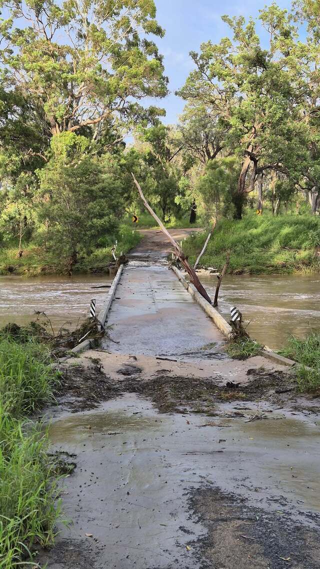
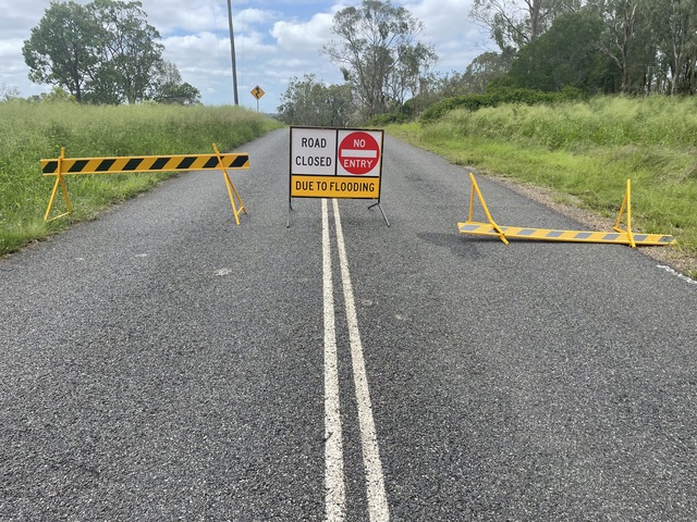
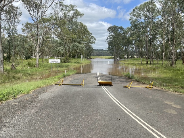
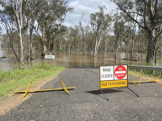
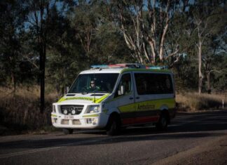
Significant rainfall and flooding has been observed across the Burnett after more than a week of almost-constant rainfall.
RAINFALL TOTALS
Rainfall totals peaked over 30mm within 24 hours in some parts of the North and South Burnett.
Burnett residents were battered with more rain from 9am Wednesday 18 to 9am Thursday 19 December.
The Bureau of Meteorology recorded that of note, Mundubbera received 78mm, West Barambah received 67mm and Mt Walsh near Biggenden recorded 74mm.
Meteorologist David Grant said recent wet weather across parts of Queensland has left some catchment areas saturated.
“Showers, rain and thunderstorms will continue to impact eastern Queensland this week,” Mr Grant said.
“Catchments areas already saturated are likely to respond quickly to further rainfall with localised creek and river level rises. Flash flooding is possible in some areas.”
“Above average rainfall occurred across much of western, southern and southeast Queensland during November, which has increased soil moisture and dam levels in many areas.”
“At this stage, long-range forecasts are favouring average to above average rainfall across much of Queensland over the next few months,” Mr Grant said.
South Burnett 24-hour rainfall totals include:
• Mt Binga 30mm;
• Blackbutt 8mm;
• Yarraman 9mm;
• Kingaroy 25mm;
• Embrey’s Bridage 31mm;
• Brooklands 20mm;
• West Barambah 67mm;
• Cherbourg 24mm;
• Ficks Crossing 16mm;
• Proston 16mm;
• Boondooma 36mm.
Meanwhile, in the North Burnett The Bureau recorded the following 24-hour rainfall totals:
• Mt Gayndah Alert: 53mm
• Mt Lawless: 13mm
• Ban Ban 15mm
• Cooranga (Boyne River) 20mm
• Biggenden 54mm
• Mt Walsh 74mm
• Paradise Dam 23mm
• Mingo Crossing 30mm
• Mt Perry 46mm
• Mt Rawdon 41mm
• Mundubbera 78mm
• Eidsvold 37mm
• Cania Dam 3mm
• Mungungo Weir 4mm
RIVER LEVELS
Waterways in the North and South Burnett swelled under last night’s heavy storms, with several breaking their banks and submerging roads and bridges in the process.
Sections of Boonara, Barambah, Barker and Degilbo Creeks were each declared as moderate or major flooding spots, with a section of Boonara Creek at Ettiewyn reaching a staggering 8.23 metres as of 3.20am this morning; the Bureau of Meteorology reports the waterway’s levels are still rising.
The Stuart River is also breaking its banks, having fully subsumed Weens Bridge and rising at Proston.
At Glenmore, Barker Creek appears to be receding, having come within just eight centimetres of reaching the highway.
Some river levels are listed below, courtesy of the Bureau of Meteorology:
• Three Moon Creek at Monto – 0.36m, rising (as of 9.17am)
• Auburn River at Dykehead – 1.20m, rising (as of 9.15am)
• Stuart River at Proston – 4.89m, rising (as of 9.00am)
• Stuart River at Weens Bridge – 8.64m, steady – 2.54m above bridge (as of 9.00am)
• Boyne River at Dunollie – 4.10m, rising slowly – 1.35m above bridge (as of 6.35am)
• Barker Creek at Glenmore – 3.92m, falling – 0.08m below highway – major flooding (as of 9.00am)
• Boonara Creek at Ettiewyn – 8.23m, rising – moderate flooding (as of 3.20am)
• Barambah Creek at Ban Ban – 5.05m, rising (as of 8.45am)
• Barambah Creek at Cherbourg – 5.29m, steady (as of 9.00am)
• Barambah Creek at Ficks Crossing – 6.70m, steady (as of 8.00am)
• Barambah Creek at Silverleaf Weir – 3.53m, steady – 1.03m above bridge – moderate flooding (as of 9.00am)
• Burnett River at Jones Weir – 2.44m, rising (as of 9.00am)
• Burnett River at Mt Lawless – 4.20m, rising – 1.90m below bridge (as of 9.34am)
• Burnett River at Paradise Dam – 0.93m above spillway, rising (as of 9.22am)
• Degilbo Creek at Coringa – 7.63m, steady – major flooding (as of 9.00am)
FLOOD WARNINGS
The Bureau of Meteorology renewed its minor flood warning for the Burnett River catchment system at 10.29am this morning, 19 December.
The Bureau has issued the Flood Warning Number at 11 with minor flooding occurring at Dunollie, possible flooding at Walla from late Thursday and minor flooding expected to be occurring at Brian Pastures near Gayndah.
However, the Bureau is predicting that there will be no significant rainfall for the next few days, giving the ground a chance to dry out.
The Boyne River at Dunollie was at 4.1 metres as of 6.30am on Thursday with minor flooding, meanwhile river levels continue to be elevated along Barker and Barambah Creeks.
At Glenmore, major flooding has been observed at Barker Creek, while moderate flooding is easing along Barambah Creek at Silverleaf Weir while minor flooding is occurring at Ficks Crossing.
The Bureau also predicts that minor flooding may occur along the Burnett River downstream of Paradise Dam.
DAM LEVELS
The Burnett’s dams have filled beyond their capacity as a result of the heavy rainfall last night.
Bjelke-Petersen and Boondooma Dams in the South Burnett and Paradise Dam in the North Burnett each stand at above 100 per cent capacity according to water services company Sunwater, with BP and Paradise spilling excess liquid into nearby waterways.
Bjelke-Petersen Dam stands at 114.42 per cent as of 10:28am, housing 154,353 megalitres of water and spilling 9,133ML a day into Barker Creek – which itself is experiencing heavy flooding in parts.
Boondooma Dam near Proston is recorded as being at 108.64 per cent, containing 221,843 megalitres of water as of 10:35am; it is spilling 14,680ML a day into the Boyne River.
Paradise Dam near Biggenden in the North Burnett stands at 110.20 per cent as of 10:43am.
The height-reduced reservoir contains 187,813ML of water and is spilling excess into the Burnett River at a rate of 39,999 million litres – 16,000 Olympic-sized swimming pools – a day.
Joe Sippel Weir west of Murgon reached a staggering peak of 194.04 per cent at 7am this morning, containing 1,382ML but spilling over ten times its capacity into Barambah Creek a day.
It has since receded to 170.39 per cent capacity but is still expected to spill over 12,000 megalitres of water throughout the day.
Silverleaf Weir has also declined from its peak of 355.60 per cent, holding over two billion litres at its highest point around 3am this morning; the weir was expected to spill over 26,500ML throughout the day, but that figure is now down to 25,247ML.
The weir still contains 1,957ML as of 10:43am – 340 per cent of its maximum capacity.
Sunwater claimed that its reservoirs’ current spilling events would not impact their respective waterways, and that people living downstream from the affected dams and weirs were not in any immediate danger.
STAND UP: COUNCIL ON ALERT
Last night, 18 December, the South Burnett Local Disaster Management Group moved its disaster warning level from Alert to Stand Up.
This morning the group met to assess the damage of last night’s storms, with Mayor Kathy Duff saying road repair costs have already climbed well past a quarter of a million dollars.
FLOODED ROADS
There are currently 67 roads closed roads due to flooding in the South Burnett region. Meanwhile, a dozen roads in the North Burnett region are affected by floods.
WHAT TO DO WHEN IT FLOODS
Does your family have a flood plan? Here’s some tips on how to be prepared this flood season:

