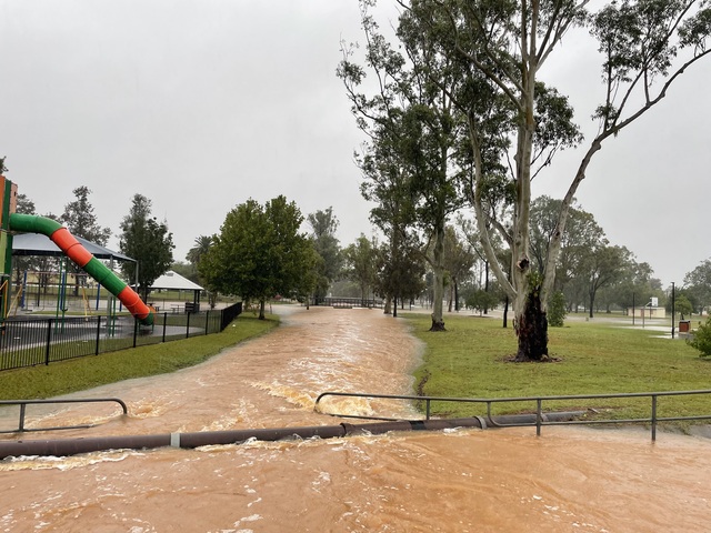
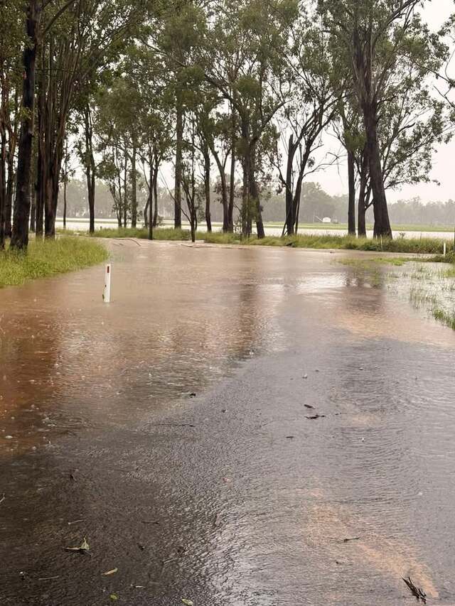
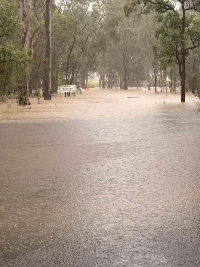
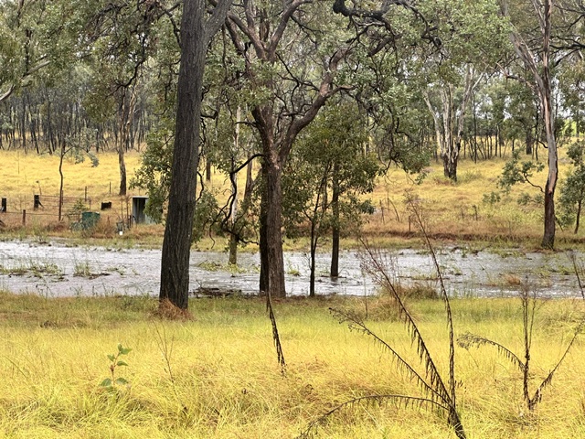
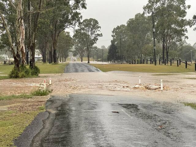

Heavy rainfall and flooding was experienced across the Burnett earlier this week.
South Burnett Regional Council were relieved to report on Tuesday, 10 March that the flash flooding threat was reduced in the South Burnett region.
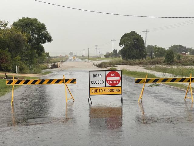
The council reported significant damage to the road network and that crews would prioritise reopening roads as soon as possible.
However, bridges will not be re-opened until inspections can be made by certified bridge inspectors.
By Tuesday, the South Burnett Local Disaster Management Group remained at Stand Up due to localised flooding still occurring in the region.
The council reported the Burnett Highway was reopened, although at the time access to Murgon was still restricted as the Bunya Highway remained closed at Krebs Bridge and Angels Bridge.
“We are working to identify priority repairs as the water recedes and I would like to thank our community for their patience at this time. I urge everyone to please report any road damage to Council on 4189 9100,” South Burnett Mayor Kathy Duff said.
The South Burnett council advised that they were receiving hundreds of road damage and had begun inspecting and prioritising repairs. However, these may take days and possibly weeks to repair.
Bureau of Meteorology Meteorologist Miriam Bradbury shared that most of the heavier rainfall totals were focussed across the Wide Bay and Burnett areas, causing flash flooding risks on Monday.
“The wet weather is continuing to be driven by a low pressure trough, and the remnants of a tropical low moving over the area,” Ms Bradbury said.
However, by Tuesday rainfalls eased off, with riverine flooding expected to continue over the following days.
The Bureau of Meteorology issued major warnings for the Burnett, Stuart and Boyne Rivers, as well as Barker and Barambah Creeks on Monday.
Most of the Burnett river levels were reported as ‘rising’ on Monday, 9 March with significant water heights observed at the following:
• Boyne River at Derra: 13.6m as of 12noon
• Auburn River at Flagstone Bridge: 14.19m as of 12.56pm
• Burnett River at Ned Churchward Weir: 20.38m as of 12.48pm
• Barambah Creek at Stonelands: 10.79m as of 11.55am (topping December 2010 levels of 9.94m)
During late Monday afternoon, the Barambah Creek at Stonelands peaked at 11.17m, with moderate flooding.
Stay up to date with the latest weather advice via the South Burnett Regional Council Disaster Dashboard: dashboard.southburnett.qld.gov.au/
RAINFALL TOTALS
Burnett Today readers shared their rainfall totals from across the region.
Naomi recorded 204mm in the 24 hours from Sunday 9am to Monday morning at Glan Devon.
“Tanks overflowing, dam is full, sheep and chooks are soggy, geese are having a great time,” she said.
Another reader shared more than 280mm was recorded at Wattle Camp from Saturday to Monday, whereas another reader welcomed 210mm at Booie.
Bob measured 125mm on 3pm Sunday at Ballogie, and another 132mm overnight to 11am on Monday.
Carol managed to record 157ml at Wondai on Monday morning, whereas Pauline measured 190mm in Kingaroy, along with water front views from the school ovals.
Di mentioned they had 320ml over 48 hours, and another 30ml in 3 hours at Tansey on Monday, and Memerambi resident Vicki recorded 265ml.
Dave recorded at Cushnie a total of 122mm on Saturday, with his rain gauge overflowing at over 160mm by late Sunday evening.
READ MORE HERE: